Special Places # 25
Special Places
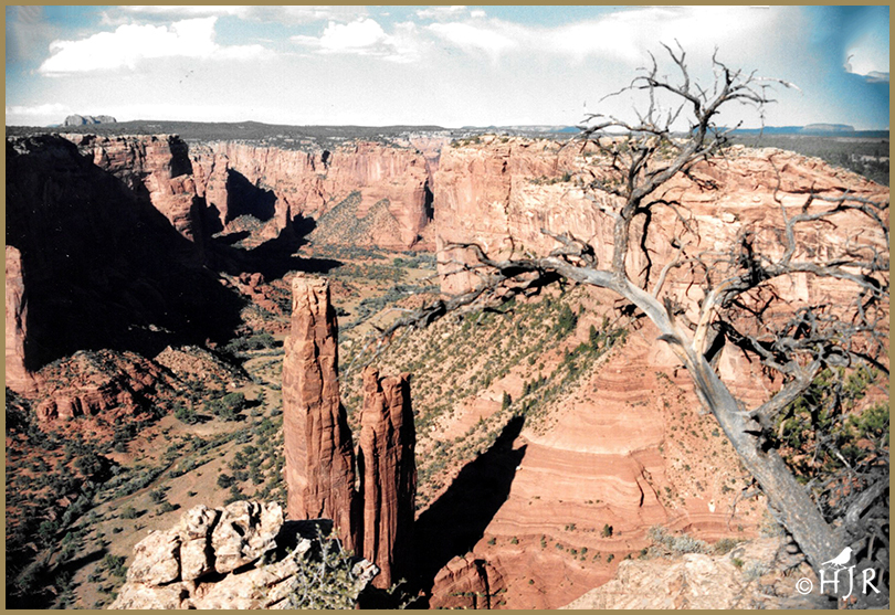
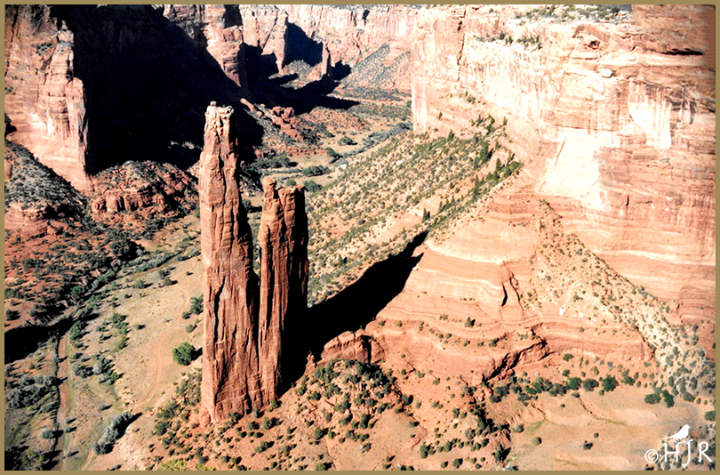
Canyon de Chelly National Monument
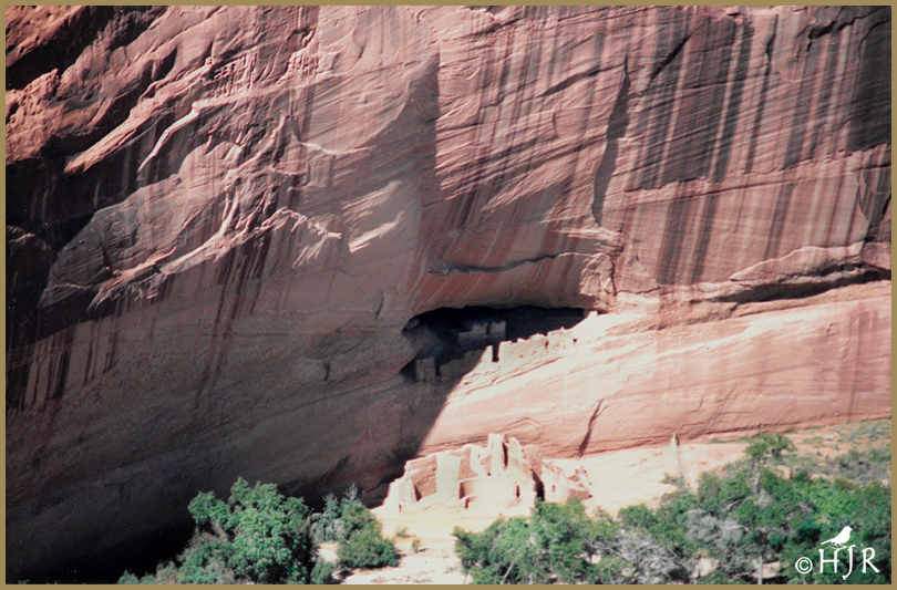
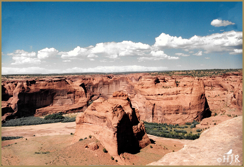
Canyon de Chelly National Monument (/dəˈʃeɪ/ də-SHAY) was established on April 1, 1931, as a unit of the National Park Service. Located in northeastern Arizona, it is within the boundaries of the Navajo Nation and lies in the Four Corners region. Reflecting one of the longest continuously inhabited landscapes of North America, it preserves ruins of the indigenous tribes that lived in the area, from the Ancestral Puebloans (formerly known as Anasazi) to the Navajo. The monument covers 83,840 acres (131 sq mi; 339 km2) and encompasses the floors and rims of the three major canyons: de Chelly, del Muerto, and Monument. These canyons were cut by streams with headwaters in the Chuska Mountains just to the east of the monument. None of the land is federally owned. Canyon de Chelly is one of the most visited national monuments in the United States
The name Chelly (or Chelley) is a Spanish borrowing of the Navajo wordTséyiʼ, which means “canyon” (literally “inside the rock” < tsé “rock” + -yiʼ “inside of, within”). The Navajo pronunciation is [tséɣi]. The Spanish pronunciation of de Chelly [deˈtʃeʎi] was adapted into English, apparently modeled on a French-like spelling pronunciation, and is now /dəˈʃeɪ/ də-SHAY.
Canyon de Chelly is entirely owned by the Navajo Tribal Trust of the Navajo Nation. It is the only National Park Service unit that is owned and cooperatively managed in this manner. About 40 Navajo families live in the park. Access to the canyon floor is restricted, and visitors are allowed to travel in the canyons only when accompanied by a park ranger or an authorized Navajo guide. The only exception to this rule is the White House Ruin Trail.
| Location | Apache County, Arizona |
| Nearest city | Chinle |
| Coordinates | 36.155281°N 109.508995°W |
| Area | 83,840 acres (339.3 km2) |
| Created | April 1, 1931 |
| Visitors | 439,306 (in 2018) |
| Governing body | Bureau of Indian Affairs |


© HJ Ruiz – Avian101


That’s some really eroded rock, great pictures.
Thank you very much, Susan. Have a great Sunday! 🙂
Great desert country HJ.
Yes, I agree. Thank you, Chris. 🙂
Quite remarkable HJ how those towers of rock stand alone in the valley in the bottom photo.
All those rock cliffs and towers were sand eons ago! Amazing stuff! Thank you very much, Ashley. 🙂
Amazing spires that are so tall and thin, can’t help but wonder if there was flooding in this area that caused the erosion. Is all the land owned by the indigenous people, or at least some? I imagine the teachings about culture are fascinating.
Whatever happen it was eons ago, before humans were walking on Earth.
No, they own only parts now. Before, they were the only inhabitants and owners of North America. Thanks,Jane. 🙂
Amazing to think about the aeons it took to carve this marvelous natural sculpture!
See how insignificant we are for the world, it’s just our ego that is bigger! Thanks, D. 🙂
It’s an amazing place, H.J. Your photos make me want to return there. 🙂
The place means a lot for Native Americans of all Nations (Tribes). Thank you, Tanja. 🙂
Gorgeous shots, HJ, of a very pretty canyon that shares lots of history. We visited this park years back, it is a hidden gem in our country!
I agree with you totally, I enjoyed it very much. Thank you, Donna. 🙂